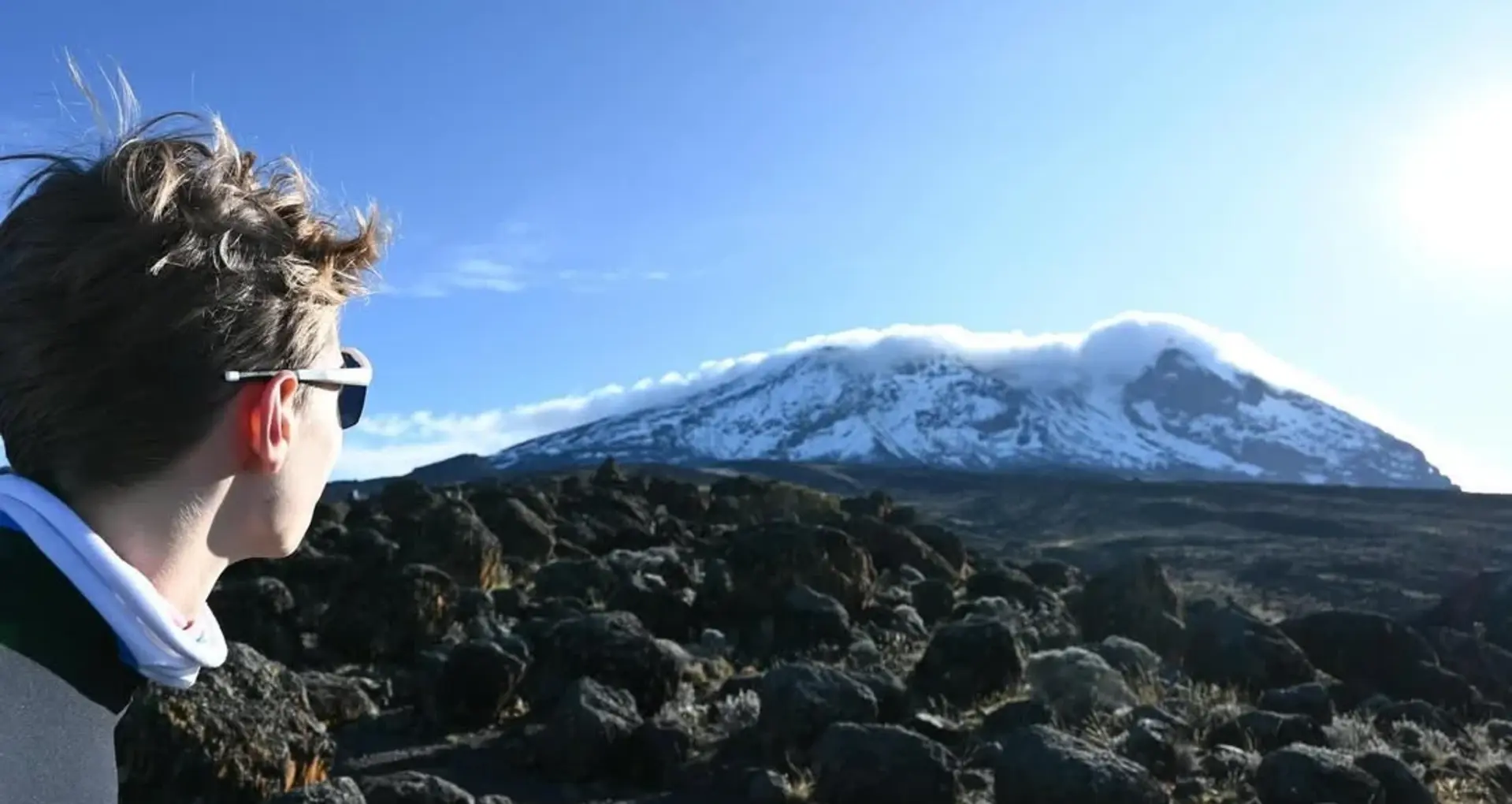
For passionate explorers and adventure seekers, understanding the terrain and geography of Mount Kilimanjaro enhances the excitement of the climb. Whether you're planning your expedition or simply fascinated by this majestic mountain, a detailed map reveals the mountain’s features, routes, and natural landmarks. At Kilisherpas Travel, we provide comprehensive insights into Kilimanjaro’s location, volcanic structure, climatic zones, glaciers, and more, helping you prepare for your unforgettable journey.
Finding Mount Kilimanjaro on the World Map
Location in Africa
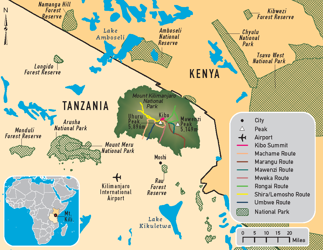
Kilimanjaro is easily identifiable on the world map: it's situated in East Africa, near the border between Tanzania and Kenya. To locate it, first find Africa, which is roughly bisected by the Equator. Kilimanjaro lies just south of the Equator, southeast of Lake Victoria, the largest lake in Africa, and close to the Kenya-Tanzania border. The mountain’s position makes it a natural landmark visible from afar.
Interactive Kilimanjaro Map
For a detailed view, explore our interactive Kilimanjaro map, which highlights the mountain’s topography and key features. The map is surrounded by roads in northern Tanzania, with the extensive green areas representing lush rainforests on its lower slopes and the brown zone indicating the rocky summit area at over 5,000 meters (16,400 feet) above sea level.
Key Features of Kilimanjaro’s Map
The Mountain’s Geography
Location: In Mount Kilimanjaro National Park, a protected UNESCO World Heritage Site.
Elevation: The mountain’s official height is 5,895 meters (19,341 feet), making it the highest peak in Africa.
Slopes and Zones: The mountain’s slopes are divided into five climatic zones, from tropical rainforest at the base to arctic conditions at the summit.
The Volcanoes of Kilimanjaro
Kilimanjaro is a dormant volcano made up of three cones:
Kibo: The youngest and highest cone, with Uhuru Peak at 5,895 meters, is the main summit climbers aim for.
Mawenzi: Located on the eastern side, standing at 5,148 meters, this rugged peak is accessible only to experienced mountaineers with technical skills.
Shira: The eroded remains of the western cone, now a flat plateau called the Shira Plateau, hosting popular routes like the Lemosho and Northern Circuit.
Natural Landmarks and Features
Glaciers: Kilimanjaro’s glaciers Furtwängler, Decken, Kersten, Rebmann, and Drygalski are located on the Kibo summit and are rapidly shrinking due to climate change.
Crater and Crater Rim: The Kibo crater, about 2.5 km across, features the Ash Pit and the Reusch crater. The crater’s rim offers stunning views and a surreal landscape.
The Mountain’s Climatic Zones and Ecosystems
Climbing Kilimanjaro involves traversing five distinct climatic zones:
Cultivation Zone: Up to 1,800 meters (5,900 feet), where local communities grow crops.
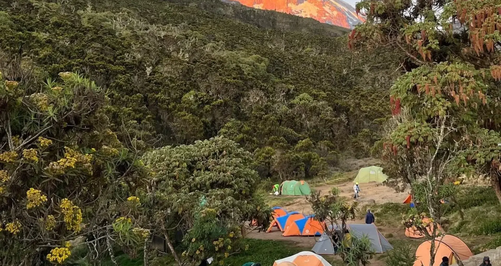
Rainforest Zone: Extends to about 2,800 meters (9,200 feet), lush and teeming with wildlife.
Heath and Moorland Zone: From 2,800 to 4,000 meters (9,200–13,100 feet), featuring unique plants like Lobelia and Kilimanjaro Groundsel.
Alpine Desert: Ranges from 4,000 to 5,000 meters (13,100–16,400 feet), characterised by rocks, mosses, and lichens.
Arctic Zone: Above 5,000 meters, a stony, icy desert with glaciers and snow caps, which are rapidly melting.
Key Points for Climber Preparation
Routes and Trailheads
The starting points of Kilimanjaro expeditions are marked on the map:
Lemosho Gate: 2,360 meters (7,740 feet). The most popular route with a high success rate.
Marangu Gate: 2,700 meters (8,858 feet). Known as the “Coca-Cola route,” it has huts for overnight stays.
Machame Gate: 1,740 meters (5,708 feet). Popular for scenic routes with varied terrain.
Rongai Gate: 1,950 meters (6,400 feet). Approaches from the north, less crowded.
Nale Moru and Umbwe Gates: Other options with varying difficulty levels.
Important Features on the Map
Tourist Camps and Lodges: Located along popular routes, providing rest and acclimatization points.
Glaciers and Ice Fields: Indicate the shrinking glaciers, vital for understanding climate change impacts.
Summit Point: Marked at Uhuru Peak, the ultimate goal of every climber.
FAQs About Kilimanjaro Map & Geography
Where is Mount Kilimanjaro Located?
In Tanzania, near Moshi, just south of the Equator, close to Lake Victoria and the Kenya border.
How Long Does It Take to Climb Kilimanjaro?
Most expeditions last 6–8 days, with routes starting at different elevations and covering various terrains.
Why Is Kilimanjaro’s Map Important?
It helps climbers understand the terrain, plan routes, identify key landmarks, and prepare for the climatic challenges of each zone.
Conclusion
A detailed map of Kilimanjaro is an invaluable tool for climbers, offering insights into its volcanic structure, natural features, and routes. Whether you’re planning your ascent or simply exploring this majestic mountain virtually, understanding Kilimanjaro’s geography enhances appreciation for its natural beauty and the challenge it presents. At Kilisherpas Travel, we’re here to guide you every step of the way – ready to help you conquer Africa’s highest peak.